What we do
Climate modelling is essential as it allows scientists to simulate and understand complex climate systems, providing insights into future climate behavior.
By simulating various climate scenarios, models
- enable to predict future climate conditions, assess potential impacts, and inform policy decisions to mitigate and adapt to climate change;
- facilitate the identification of vulnerable regions and populations, guiding targeted interventions and resource allocation to minimize the adverse impacts of the changing climate.
Our expertise covers -amongst other- heat stress modelling (from urban to street level scale), impact quantification of climate change (health, biodiversity, infrastructure, energy, …), computation of agricultural indicators, modelling of climate extremes, performing seasonal forecasts, …
Results
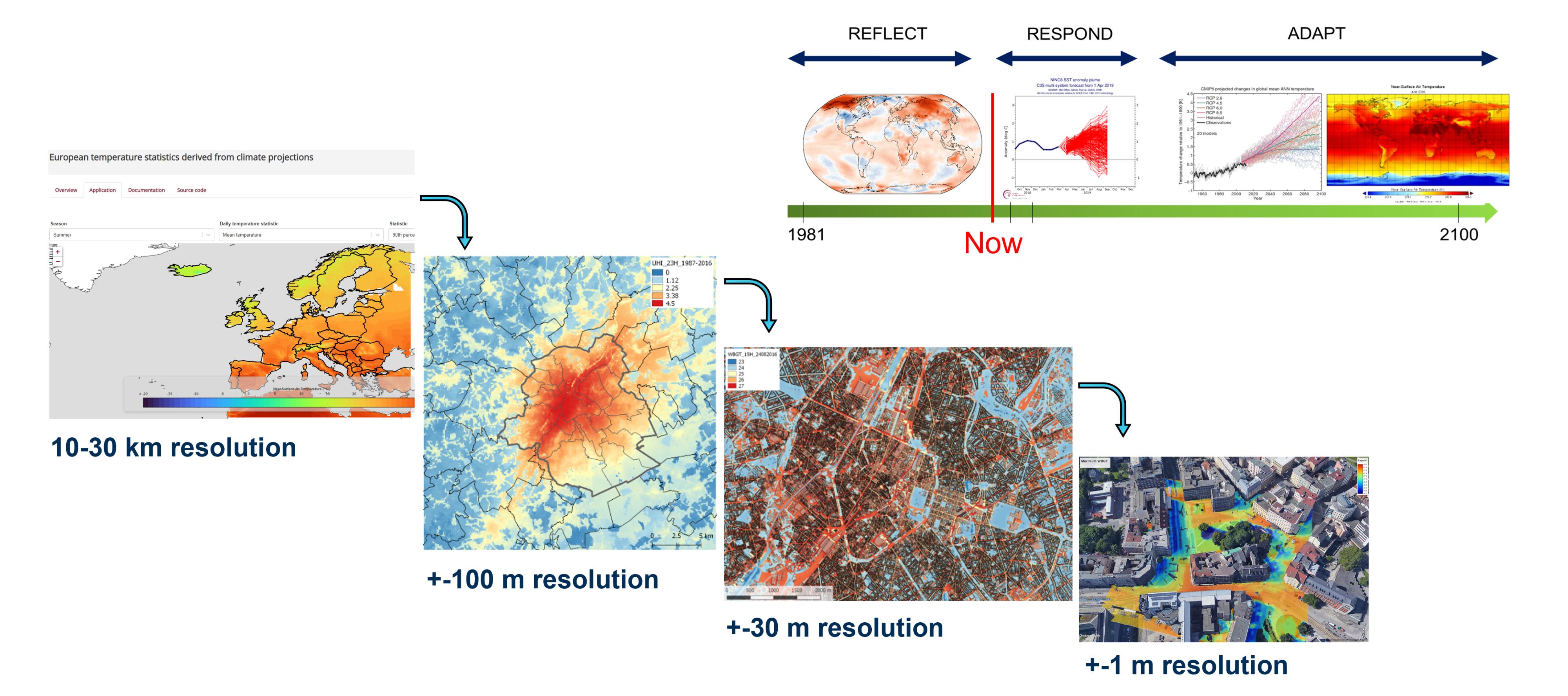
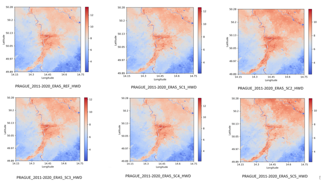
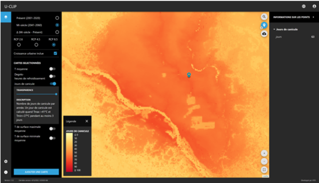
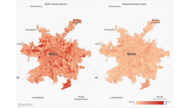
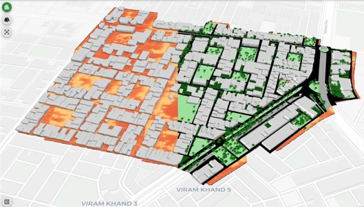
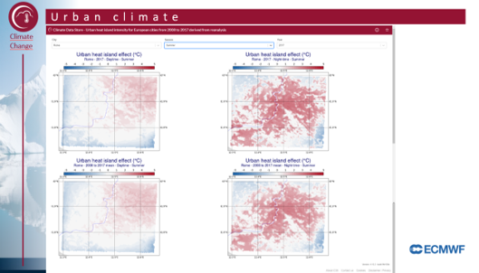
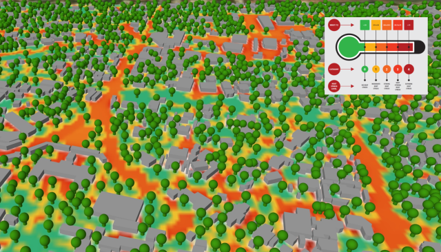
Heat stress modelling is critical for assessing the potential impacts of rising temperatures on human health, agriculture, infrastructure, ecosystems, ... informing adaptation strategies to mitigate the adverse effects of extreme heat events.
- We work through space and time, covering from regional to street level and from historic assessment to future scenarios, using in-house-developed models, i.e. UrbClim (De Ridder, K. et al., 2015) and HiRex (Lauwaet, D. et al., 2018; Souverijns, N. et al., 2022);
- We quantify both, the impact of climate change across a wide range of sectors, including health, agriculture, biodiversity, ... , and the impact of climate adaptation measures on these sectors.
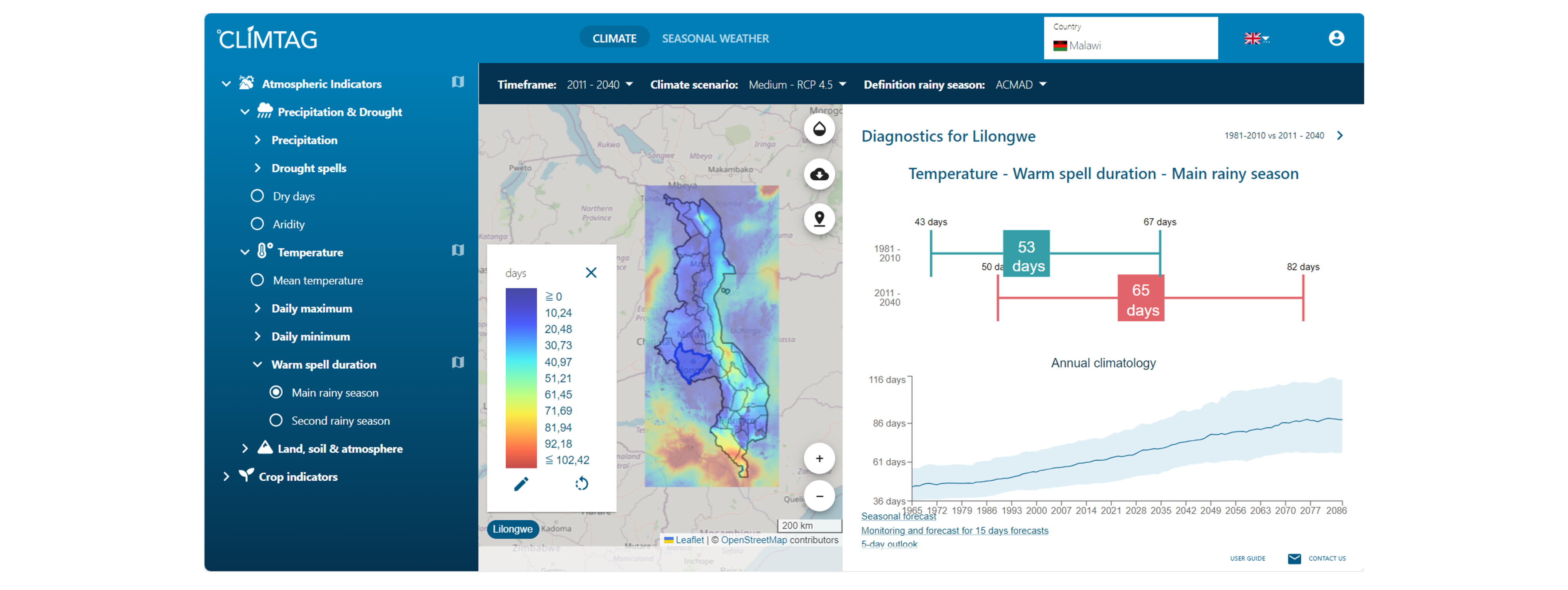
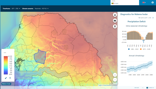
Computing agricultural indicators with scientific models in climate research is vital for understanding the complex interactions between climate variables and agricultural systems, enabling informed decision-making, adaptation strategies, and the development of resilient farming practices to safeguard food security in a changing climate.
- We unlock existing climate data by translating the data into actionable information;
- We offer tailored agro-climate indicators that are useful for impact assessment and adaptation planning, via our in-house-developed platform CLIMTAG.
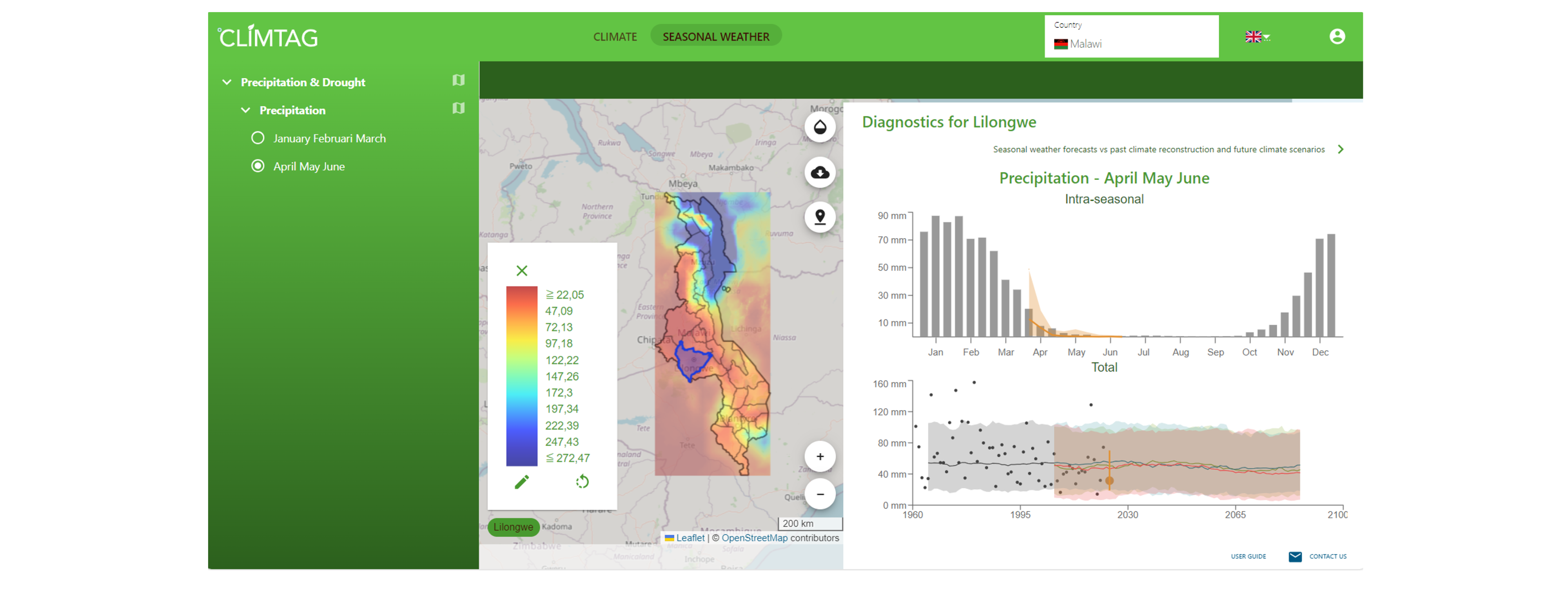
Performing seasonal forecasts in climate research is essential for anticipating weather patterns and climate variations on a seasonal timescale, enabling proactive decision-making in agriculture, water resource management, and disaster preparedness to mitigate the impacts of climate variability and enhance resilience in vulnerable regions.
- We report accumulated rainfall amount for two upcoming seasons down to the level of districts, also including the onset of the rainy season and 10-daily rainfall amounts;
- We offer a visually intuitive presentation that allows the user to:
- directly compare forecasted rainfall with those of the past 50 years and climate projections;
- easily interpret reliability and uncertainty associated to the forecasts.
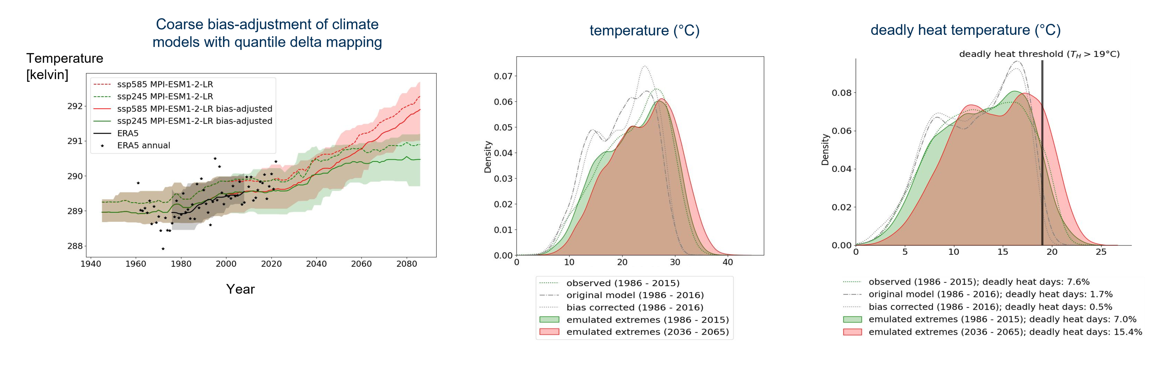
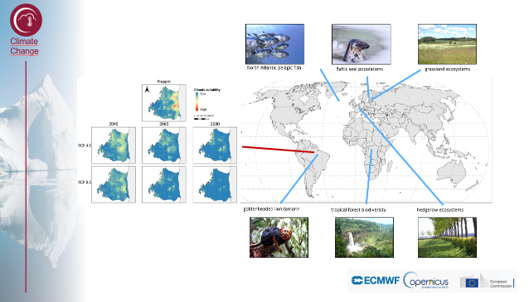
Modelling climate extremes in climate research is crucial for understanding the frequency, intensity, and spatial distribution of extreme weather events, providing essential insights for risk assessment, adaptation planning, and resilience-building efforts in the face of climate change.
- We provide time series of future weather extremes across the globe, by combining climate projections, reanalysis data and weather station data;
- We offer risks assessment of any type of weather extreme that can be observed by weather stations, including extreme temperature, heavy precipitation, heavy wind and heat stress.
Showcase projects

C3S European Health
The Copernicus Climate Change Service (C3S): Sectoral Information System (SIS) for European Health.
Europe
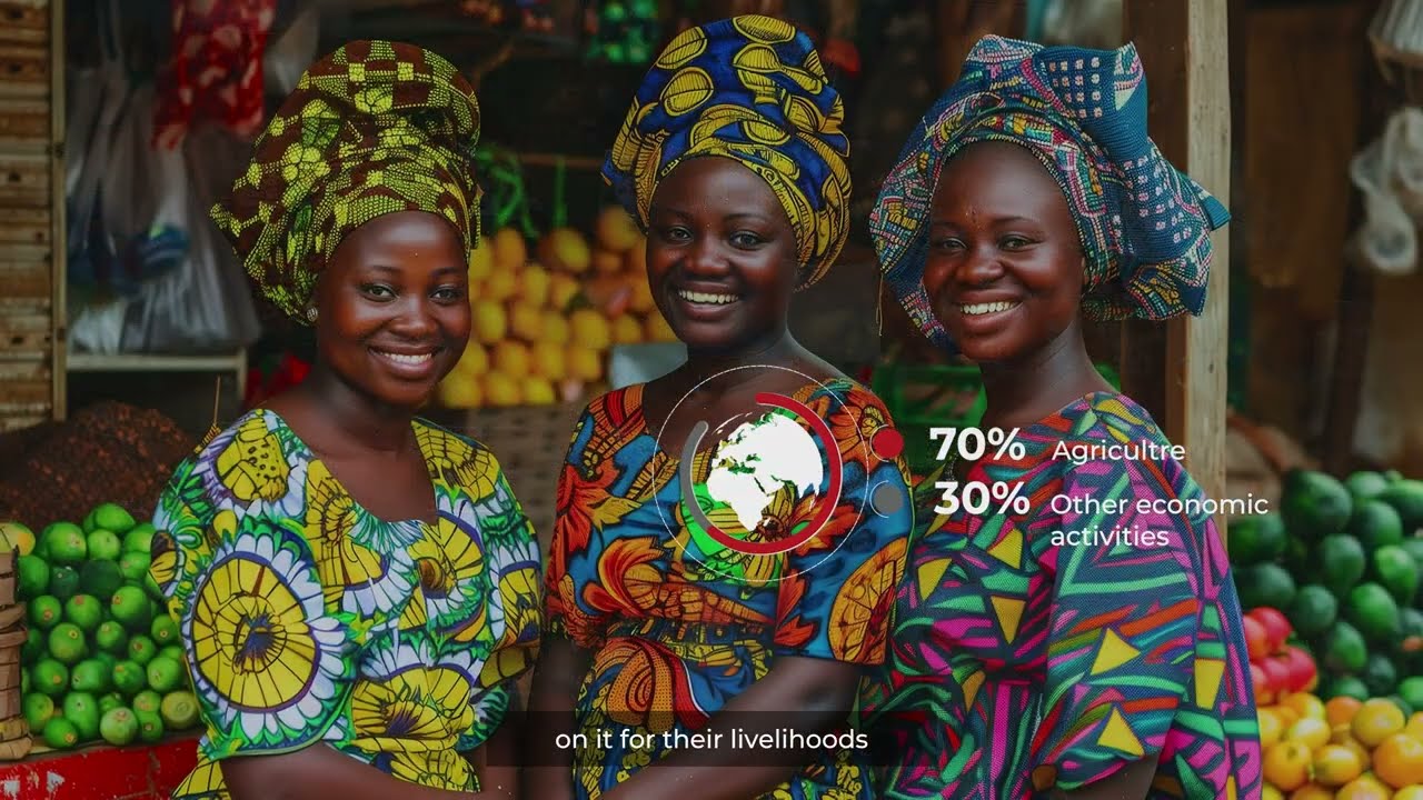
Climate Platform for Adaptation in Agricultural Sector, Africa
Publication in the spotlight
Abstract
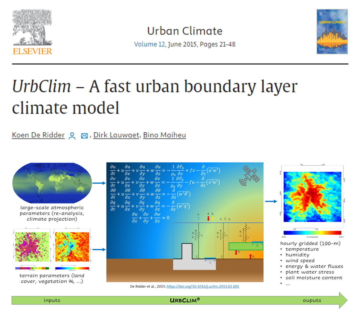
We present a new urban climate model, further referred to as UrbClim, designed to cover agglomeration-scale domains at a spatial resolution of a few hundred metres. This model is composed of a land surface scheme containing simple urban physics, coupled to a 3-D atmospheric boundary layer module. In the land surface scheme, urban terrain is represented as an impermeable slab with appropriate parameter values for albedo, emissivity, and aerodynamic and thermal roughness length, and accounting for anthropogenic heat fluxes. The UrbClim model is subject to several validation exercises, using observations from Toulouse (France), Ghent and Antwerp (Belgium), and Bilbao (Spain), and considering turbulent energy fluxes, wind speed, and urban–rural temperatures. Despite its simplicity, UrbClim is found to be of the same level of accuracy than more sophisticated models, including for the complex terrain characterizing the Bilbao area. At the same time, it is faster than high-resolution mesoscale climate models by at least two orders of magnitude. Because of that, the model is well suited for long time integrations, in particular for applications in urban climate projections.