Context
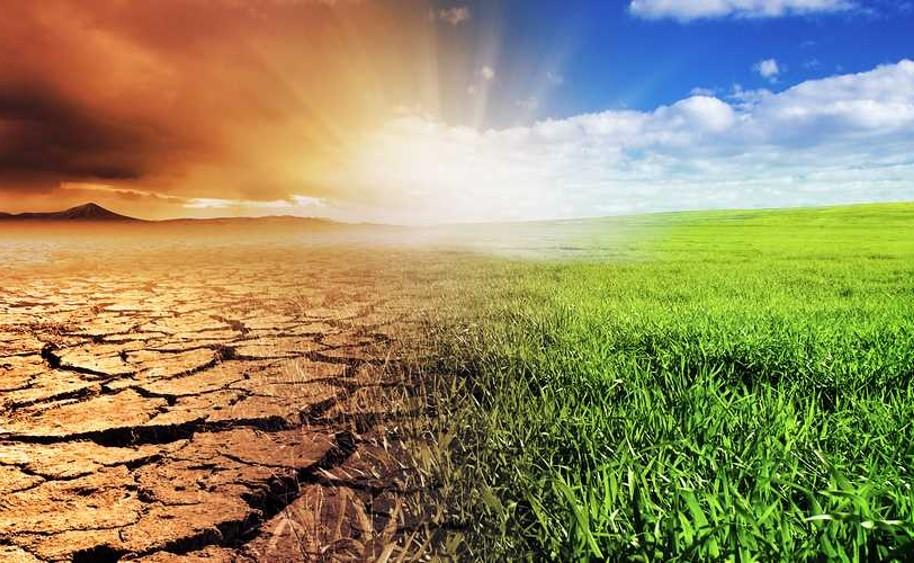
Being strongly weather-dependent, agriculture is very vulnerable to weather variability and climatic changes. Climate change is expected to increase weather variability and to make certain warm and drought-prone regions even drier and hotter. In addition, rainfall patterns and the associated crop calendars and management practices may shift.
Adapting existing agricultural systems is essential to render the systems as resilient as possible to climatic changes and extreme weather events, as well as to maximise agricultural yields.
Tailored information about the past, current and future climate is very important. To assess the impact of climate change and design adaptation strategies, climate information should be region-specific, reliable, actionable, and easily accessible.
Solution
A wealth of climate data exists. Yet, these data are often inaccessible due to their difficult format, inappropriate resolution or raw character that is not tailored to the need of stakeholders active in the field.
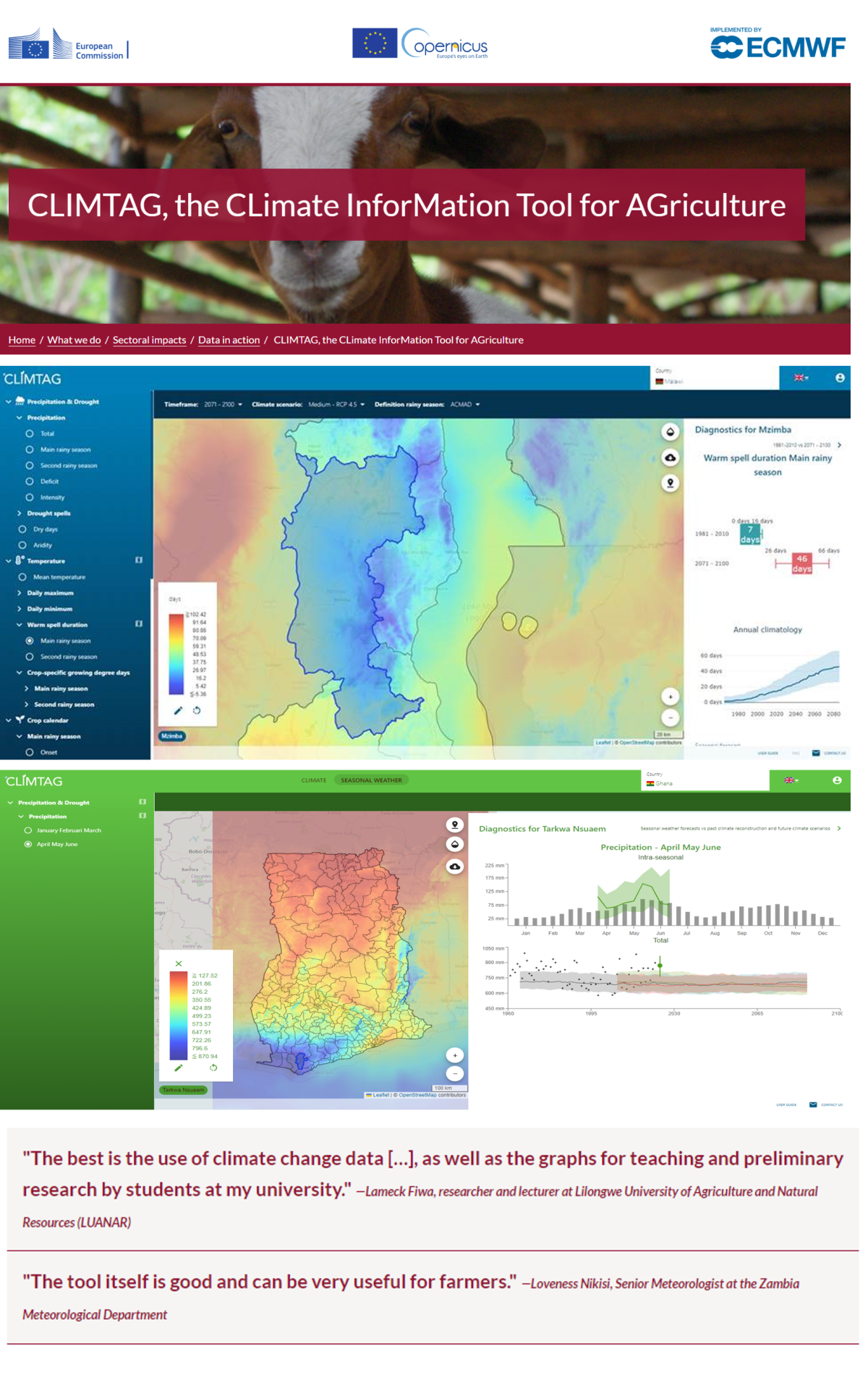
CLIMTAGTM, the CLimate InforMation Tool for AGriculture, unlocks these data by translating raw climate data into actionable information. It is a web-based tool, designed and produced via a co-creation trajectory, offering tailored agro-climate indicators that are useful for impact assessment and adaptation planning.
User requirement analysis and stakeholder feedback shaped the agro-climate tool and service, so that it provides relevant climate information tailored to the needs of its users.
Discover
Exploring the wealth of agro-climatic indicators is made easy through an attractive web interface.
Explore the CLIMTAG tool !
For more information, please
About the tool
CLIMTAGTM is a web-based tool that unlocks existing but inaccessible climate data by translating the raw data into actionable information, e.g. as agro-climate indicators for the past, present and future, based on quality-assured climate data from the Copernicus Climate Data Store (CDS).
For defining the indicators, we rely on cooperation with experts from, among others, National Meteorological Services, Departments of Agriculture, the African Centre for Meteorological Applications for Development (ACMAD) and the Food and Agricultural Organization (FAO). The indicators are related to rainfall, temperature or crop calendars, and give for example information about the start of the rainy season or the duration of a drought period.
CLIMTAGTM uses temperature, precipitation and a variety of other climate data from past reanalysis climate reconstruction (‘ERA5/6 reanalysis’) and future climate projections (‘CMIP5 projections’) to calculate operational agro-climatic indicators. The CMIP5 climate projections are bias-corrected to strengthen their consistency with the past observed climate.
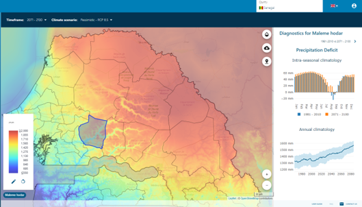
CLIMTAGTM operates at country level and visualises past, present and future climate information. Within the tool, users can select the dataset (ERA5 vs. CMIP5), time horizon (past, present to near future, medium-term future and far future) and climate indicator of interest. The climate information appears in a dynamic and customisable country map at a resolution of one kilometre. In addition, within-season variability and future trends can be explored at district level via intuitive graphs. Users can also download the information for further use in documentation or downstream applications.
As such, CLIMTAGTM provides its users with accessible climate information to support planning and management of agriculture-related activities.
What you can expect
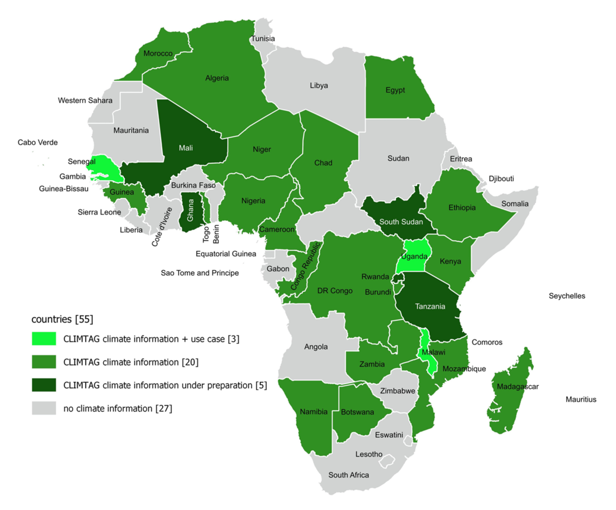
CLIMTAGTM has originally been developed to offer climate information for Malawi, Mozambique and Zambia, including 23 agro-climatic indicators. Yet, after the geographical and thematic upscaling, CLIMTAG-Africa offers information for over 20 countries in Sub-Saharan Africa and includes more than 50 agro-climate indicators.
CLIMTAGTM aims to provide decision makers in the agricultural sector with operational climate information. It allows its users to assess the severity of upcoming climatic changes, design robust national adaptation measures (which can form part of National Adaptation Plans), or compose strong applications for international climate funds.
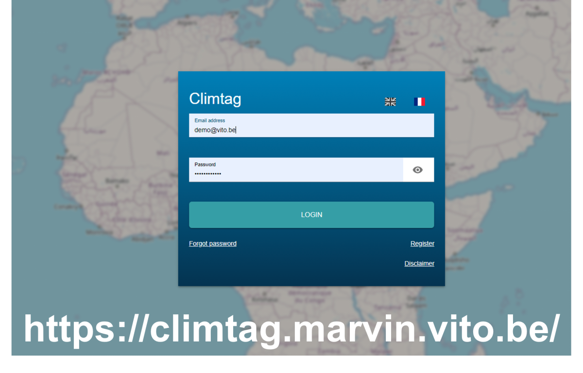
The main target users are National Meteorological Services, but national Ministries, policymakers and international development organizations are also making use of the practical information that CLIMTAGTM provides. Users need a personal login to consult country-specific information but a light demo version is available from the CLIMTAG website.
By providing applicable climate indicators that have been selected in close collaboration with its stakeholders, CLIMTAG supports robust adaptation of agricultural practices, in the first place in Africa where the livelihood and food security of many rely on agricultural production.
How it began